Stratolloon
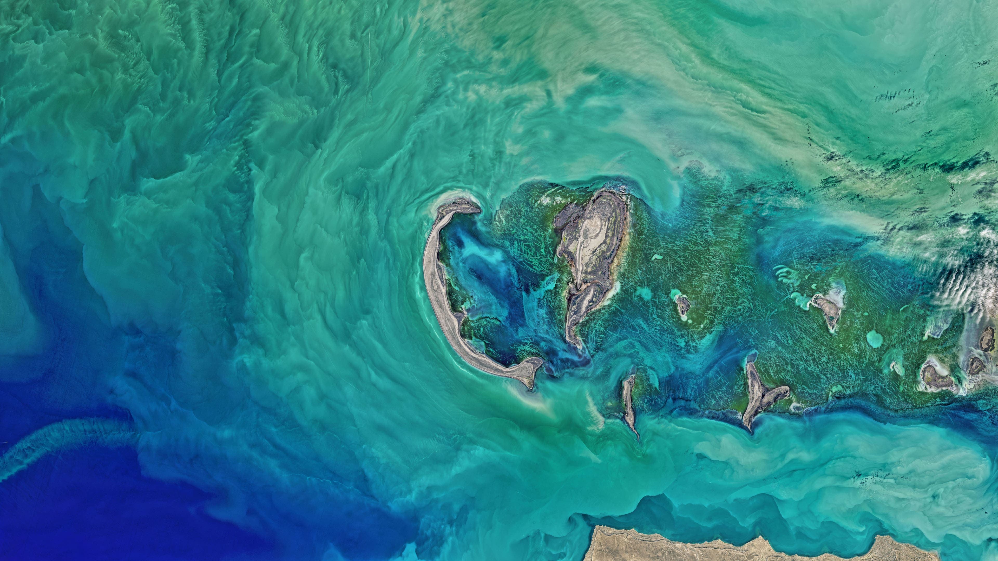
A startup from Valencia that set out to reach the stratosphere, and ended up reading the planet from orbit.
2017 to 2020
2017
Ground level, Valencia
The idea came from a crash
Jorge Sancho was an aerospace engineering student at the Universitat Politècnica de València when he watched a Google stratospheric balloon come down in Los Angeles. The payload landed wherever the wind put it.
Balloons are the cheapest way to lift instruments to the stratosphere. Getting them back is the hard part. Around 70% of payloads are lost or damaged on landing, because a parachute cannot choose where it comes down.
The answer was a reusable high-altitude laboratory. Once the mission ended, the capsule would receive a landing signal, drop the balloon and fly itself down on four rotors, away from air routes and towns, to a chosen spot. It entered the European Satellite Navigation Competition as a concept and a video, and won. Separately, the European GNSS Agency's E-GNSS Accelerator ranked it among the ten best projects in Europe.
European Satellite Navigation Competition 2017Winner, Valencian Community
GSA E-GNSS Accelerator 2017One of the 10 best projects in Europe

2018
20 km, the lower stratosphere
Designing the drone
The 2017 results came with a place at StartUPV, the university incubator, in February 2018. IDEAS UPV gave the team its first office on the Vera campus.
That year Alex Caballero joined as co-founder and CTO. An industrial engineer with a background in product design and factory IoT, he turned the concept into something that could be built, and started drawing the hardware in 3D.
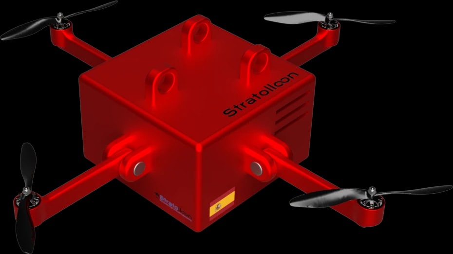
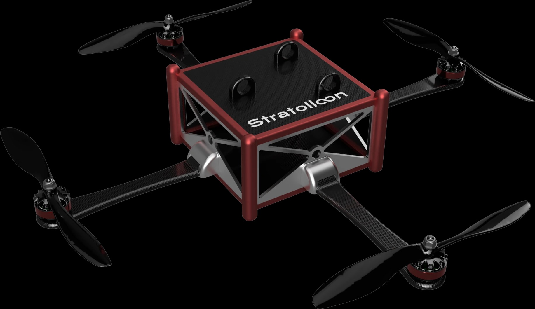
The first concept in May was a sealed red box on four arms. By July it had become the SL-0: an open frame with a balloon coupling system on top, a cargo bay in the middle and electric motors at each corner. Modular, reusable and cheap enough to fly again and again.
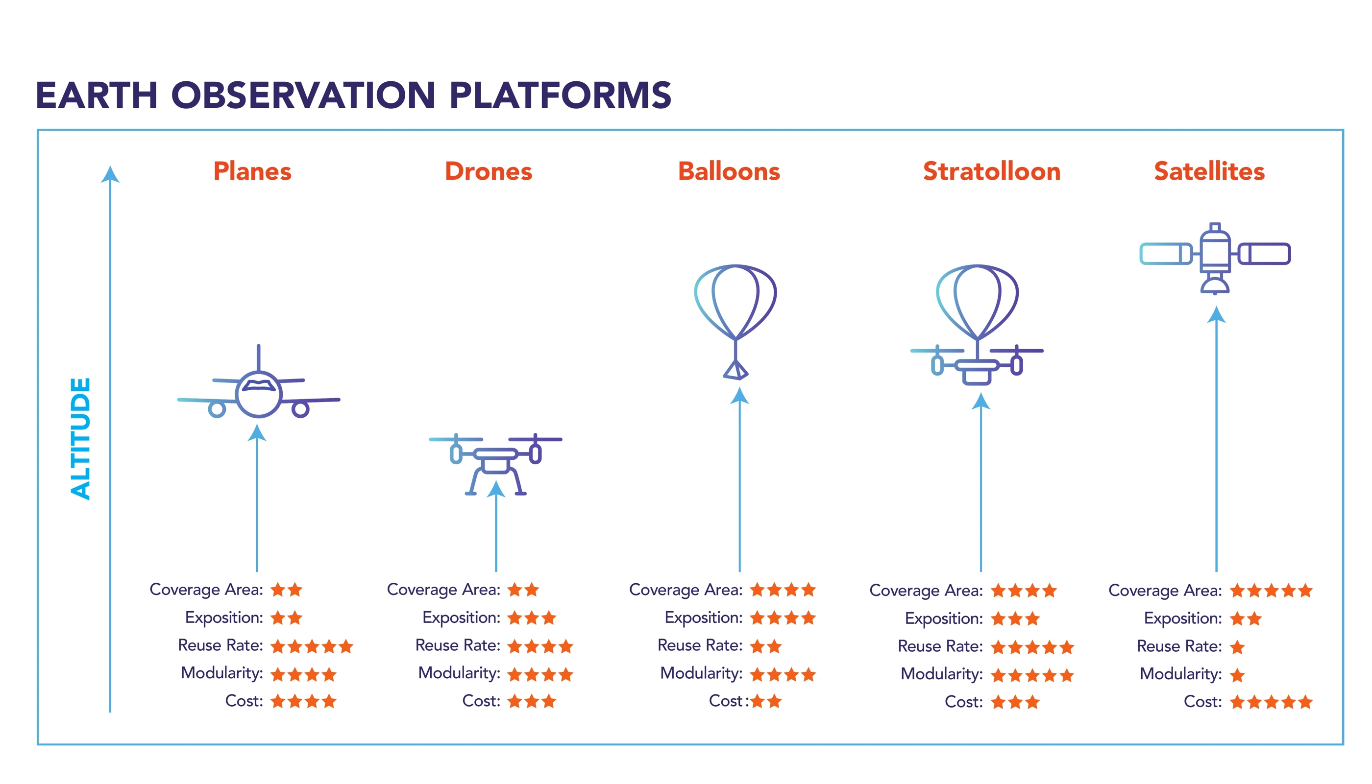
It sat in a gap nobody covered well. Planes and drones fly too low, satellites pass too rarely and cost too much, and ordinary balloons are lost after a single flight. In Europe, the competition that started it all named Stratolloon its winner for a second year.
Galileo Masters 2018 (European Commission and ESA)Winner, Valencian Community
StartUPV 2K18Winner
5U CV StartupWinner, junior category
2019
30 km, the SL-0 ceiling
The stratosphere at a click
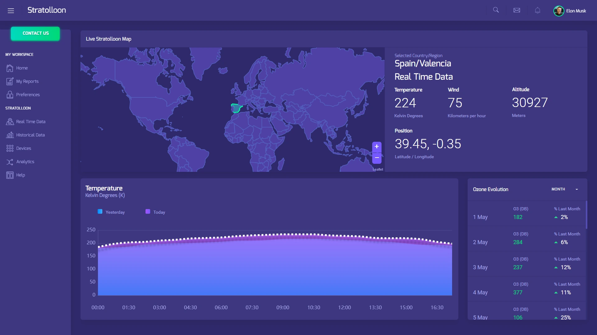
The business model fit on one slide: one product, three revenue streams. Custom missions to carry payloads above 20 km. A subscription to stratospheric data, collected by the Stratolloon network and shown live on a web dashboard. And the hardware itself, for teams with their own balloons.
The first functional IoT prototype was built in spring and tested on the ground in real conditions through the summer. Aerospace and defence, telecoms and weather services were the customers in mind.
Winning Santander Explorer at the UPV sent Alex to Silicon Valley, and the project reached the national final of the Disruptive Technology Award. By the end of the year the team had joined EIT Climate-KIC's Greenhouse programme, the climate initiative of the European Institute of Innovation and Technology.

Premis València EmprénFirst prize

Santander ExplorerWinner, UPV
Explorer Disruptive Technology AwardNational finalist, sponsored by Banco Santander and Indra

EIT Climate-KIC GreenhouseNational selection by the European Institute of Innovation and Technology
2020
100 km, the Kármán line
Geospatial intelligence made easy
Building hardware for the stratosphere was slow and expensive, and satellites already passed over every point on the planet. So Stratolloon, now a company with two founders, kept the question and dropped the hardware. What can you learn about a place from above?
The new product was a geospatial intelligence platform. It combined satellite imagery with in-situ data layers and ran the analysis automatically, so a team could get answers about any area, past or present, without hiring remote-sensing experts.
It was built for the sectors that live on that kind of answer: insurers assessing damage after a flood, energy companies siting a solar plant, governments and smart cities, logistics, climate research. Agriculture got its own app, monitoring fields from Sentinel-2 with web and mobile clients. Five companies piloted the platform.
A rebrand followed in August, with a new mark built for screens rather than for painting on a drone. Two European accelerators took the company in: PARSEC, an accelerator for Earth observation startups funded by the European Commission's Horizon 2020 programme, and EIT Climate-KIC. In December, StartUs Insights named it one of the top five Earth exploration startups in the world.

UPV Social Council Awards 2020Best project, Business and Management Culture Chair

PARSEC AcceleratorSelected, one of 100 startups in Europe
EIT Climate-KIC AcceleratorSelected by the European Institute of Innovation and Technology, one of 13 startups in Spain

StartUs InsightsOne of the top 5 Earth exploration startups, out of 601 worldwide

The agriculture app, 2020
Field monitoring from Sentinel-2, on the web and on the phone, as the pilot customers used it.

Vegetation indices for each field on iPad, cycling through NDVI, CVI and more. 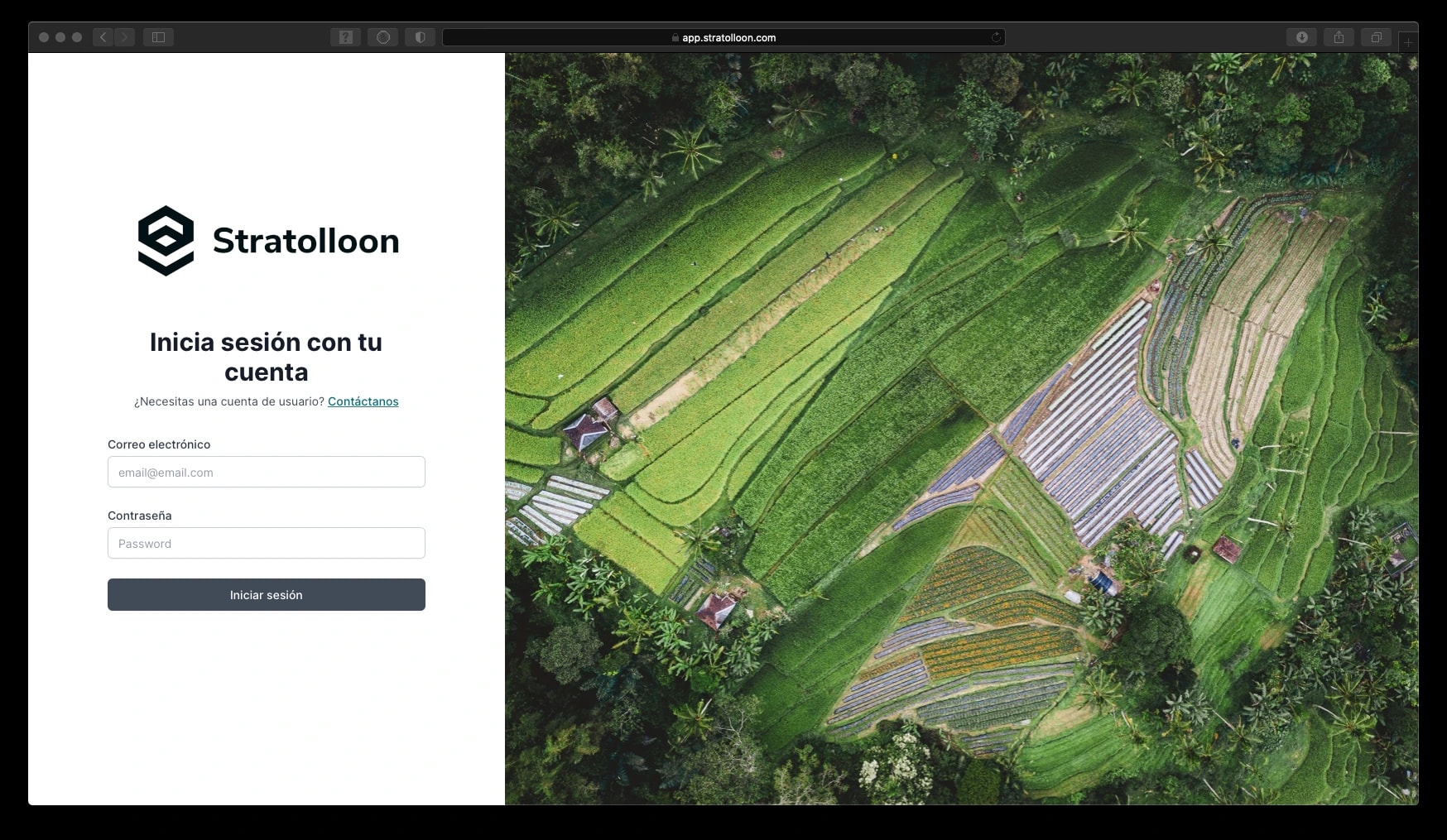
The sign-in screen, after the 2020 rebrand. 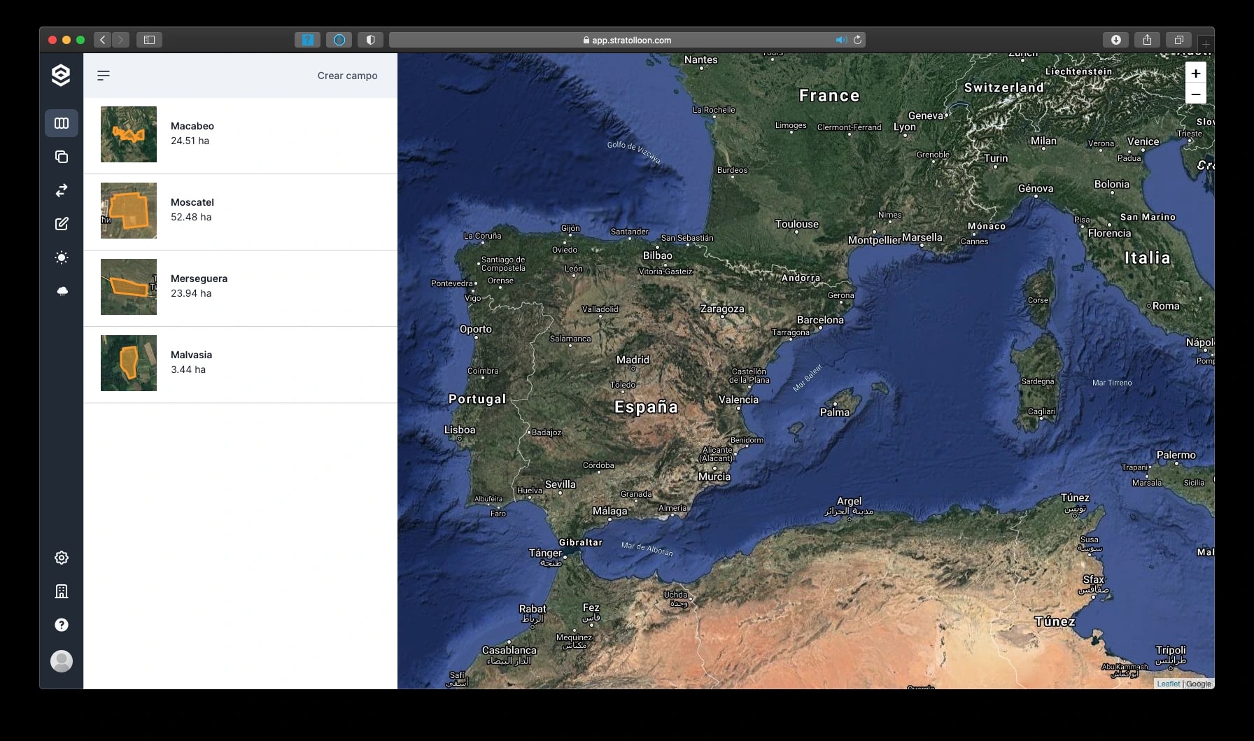
A customer's fields, each with its area. 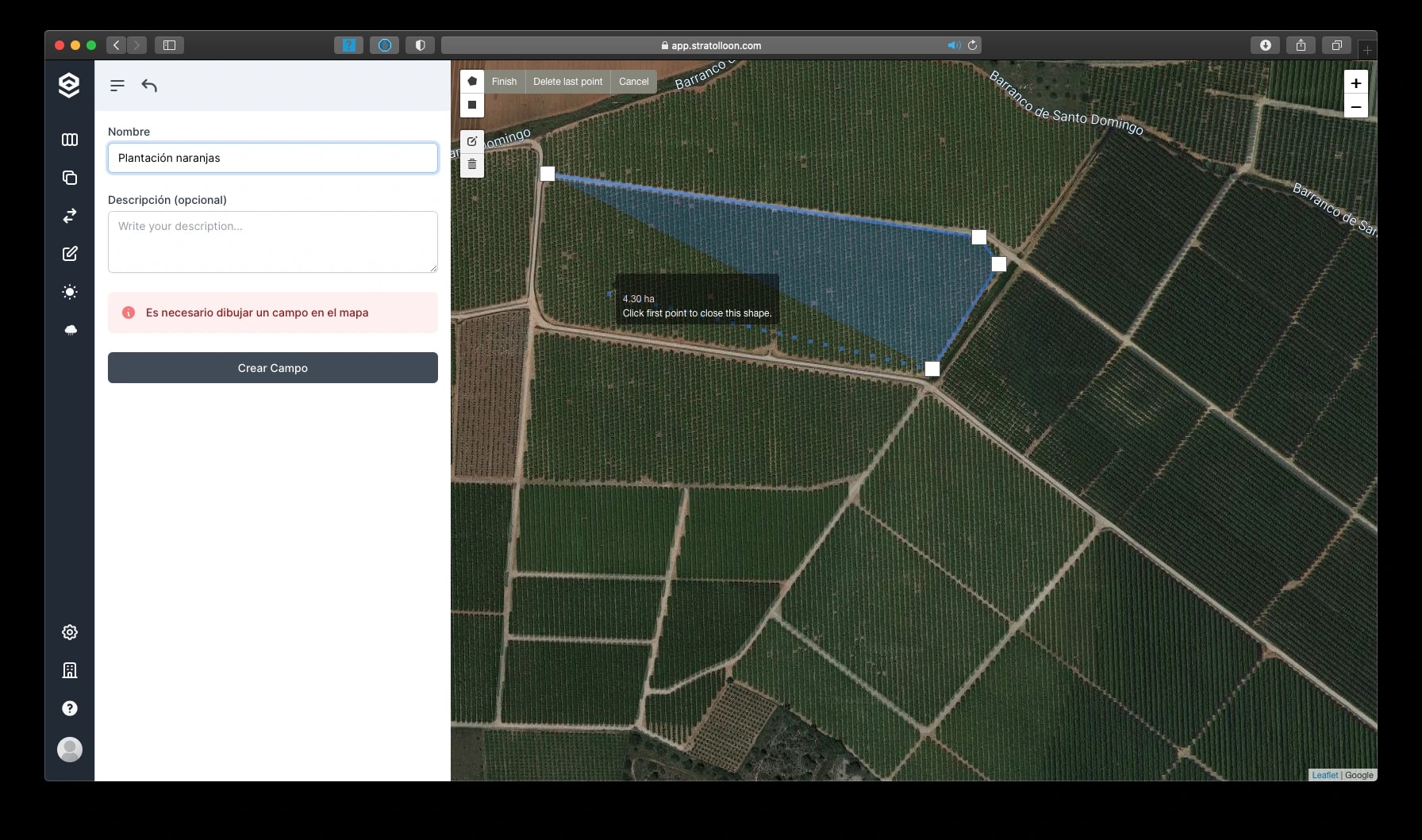
Drawing a new field on the map. 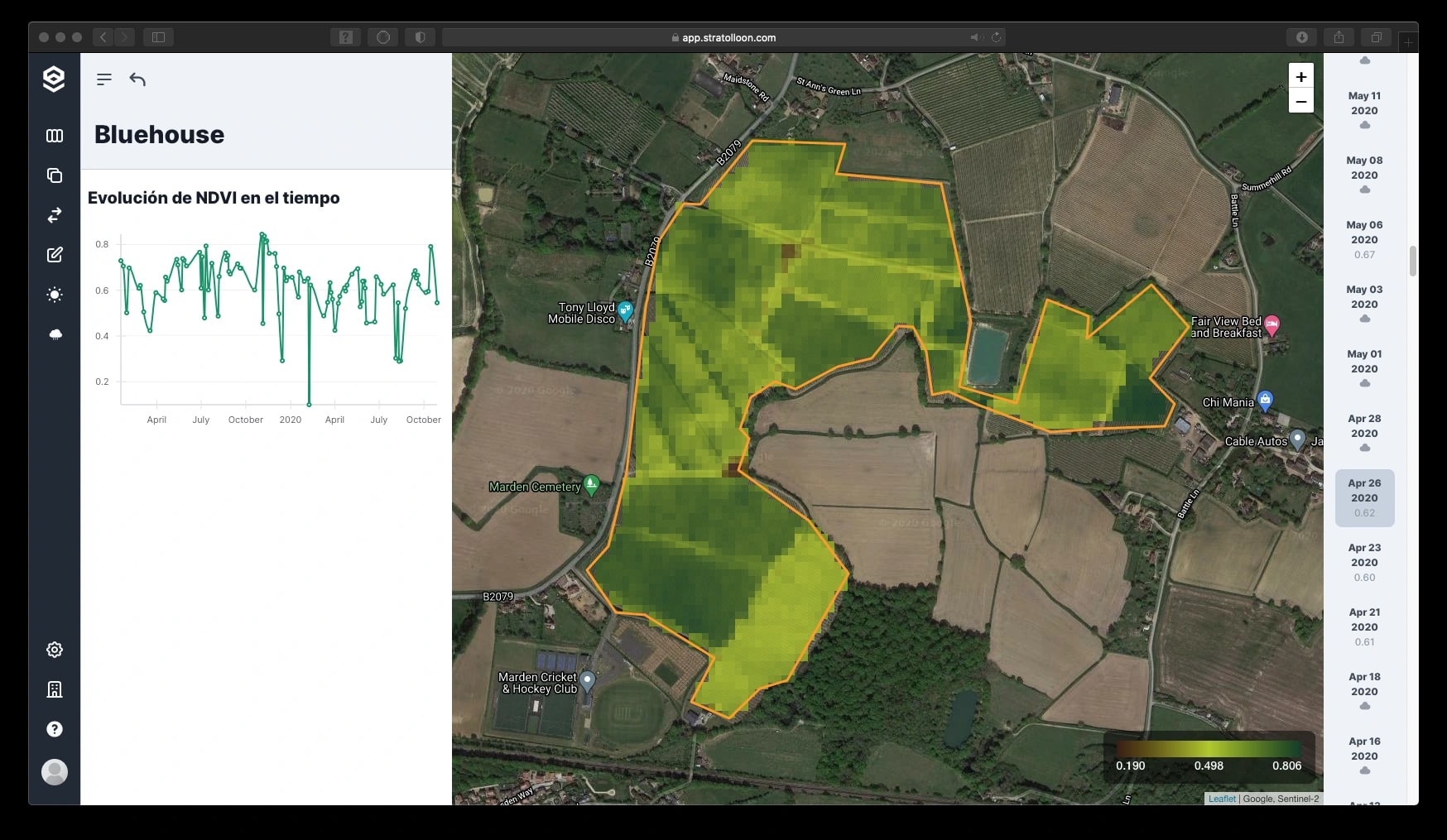
NDVI for one field, with its history over time. 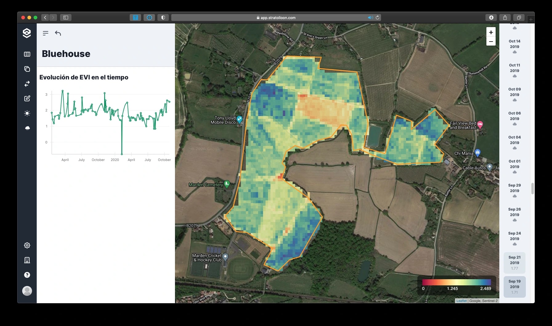
The same field as EVI. 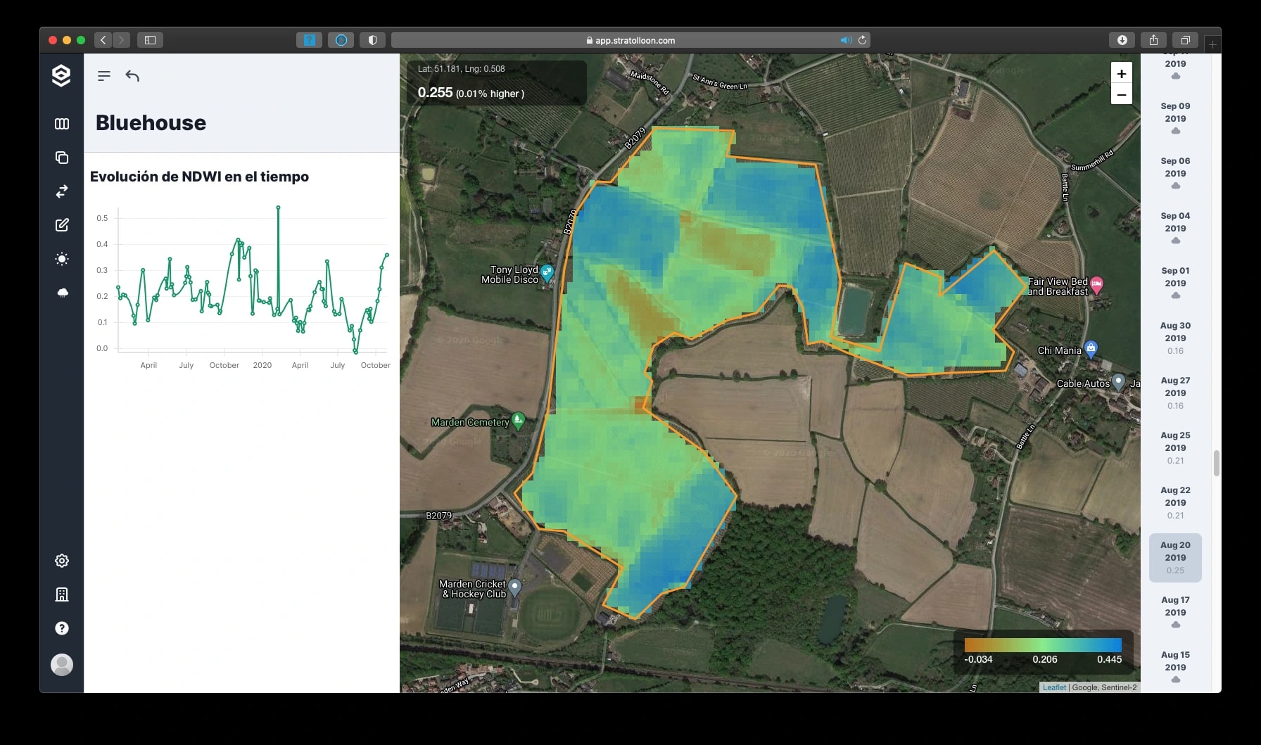
Water content across the field, as NDWI. 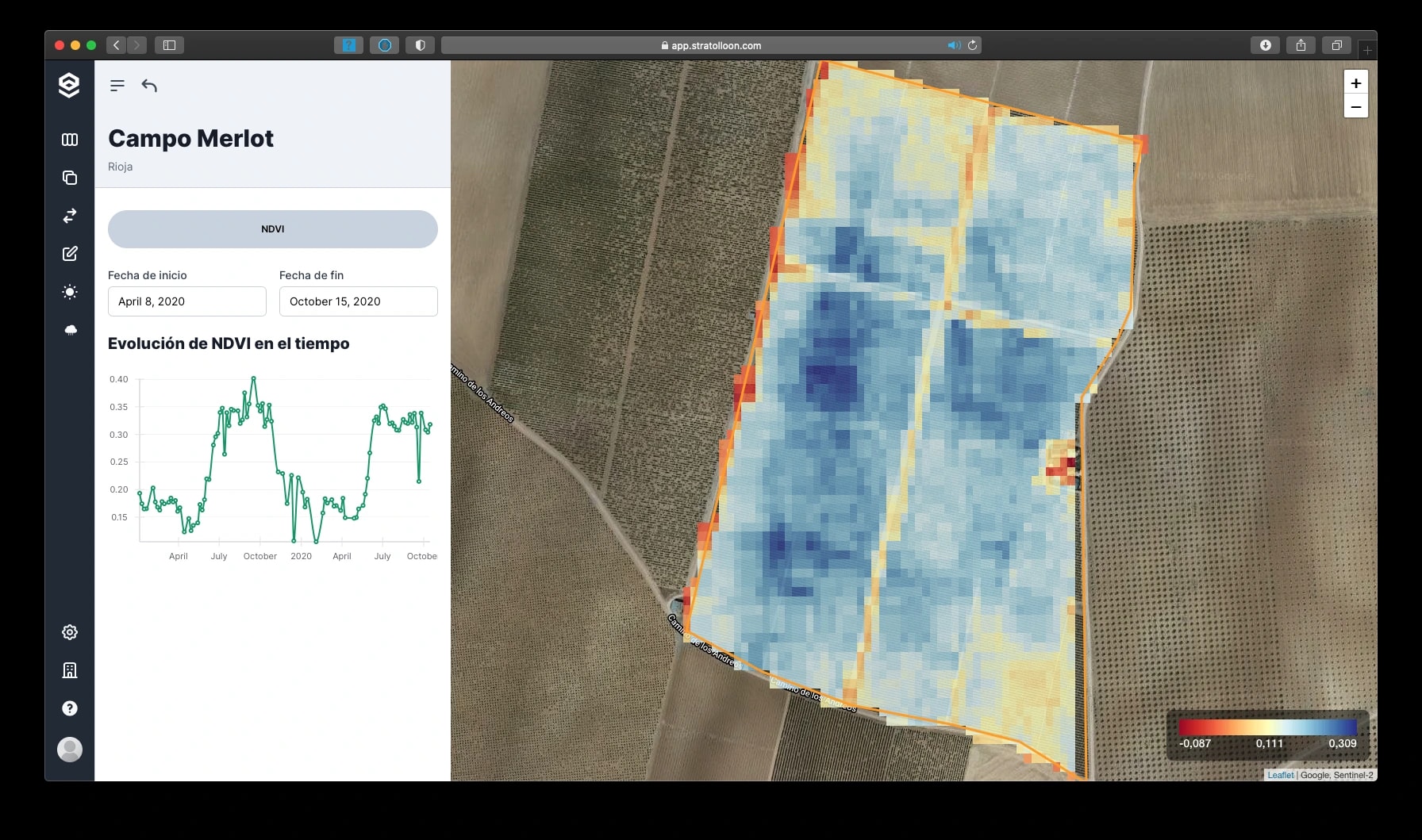
A vineyard's NDVI, April against October 2020. 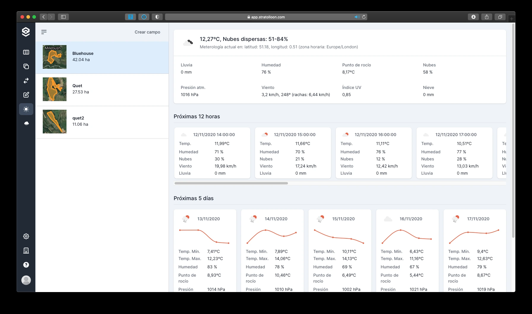
The 12-hour and 5-day forecast for each field. 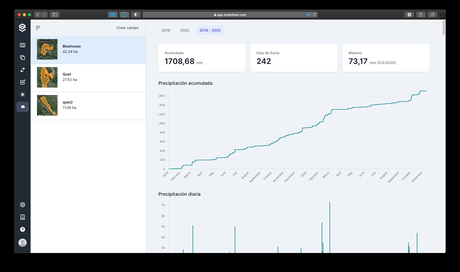
Accumulated and daily rainfall.
Mission
Our mission is to help you better understand our planet

The view from 786 km
Analyses the team produced from open satellite data, kept as they were delivered.
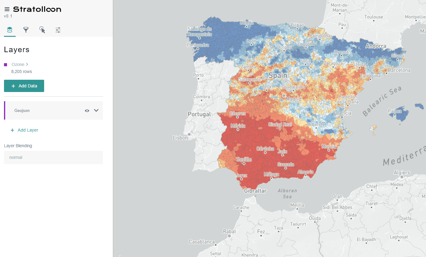
Platform v0.1: ozone levels across Spain, by municipality. 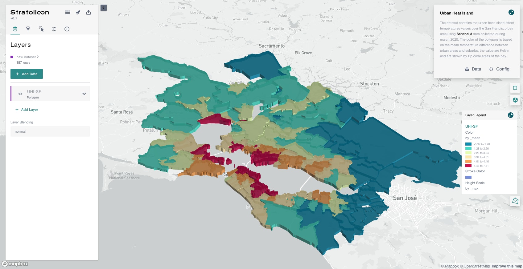
Smart cities: the urban heat island of the San Francisco Bay Area, from Sentinel-3. 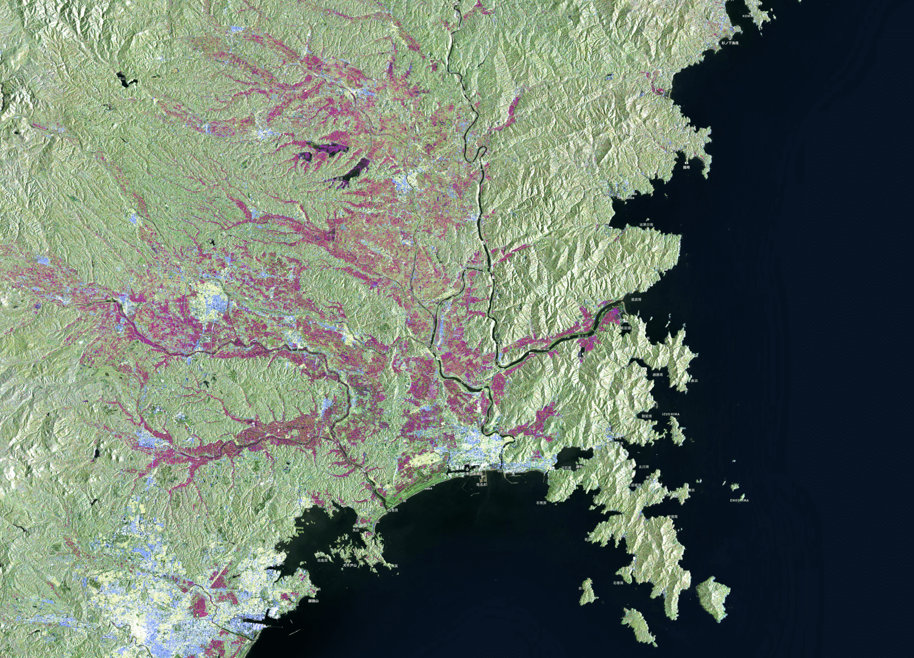
Insurance: flooded land in Miyagi, Japan, after Typhoon Hagibis. 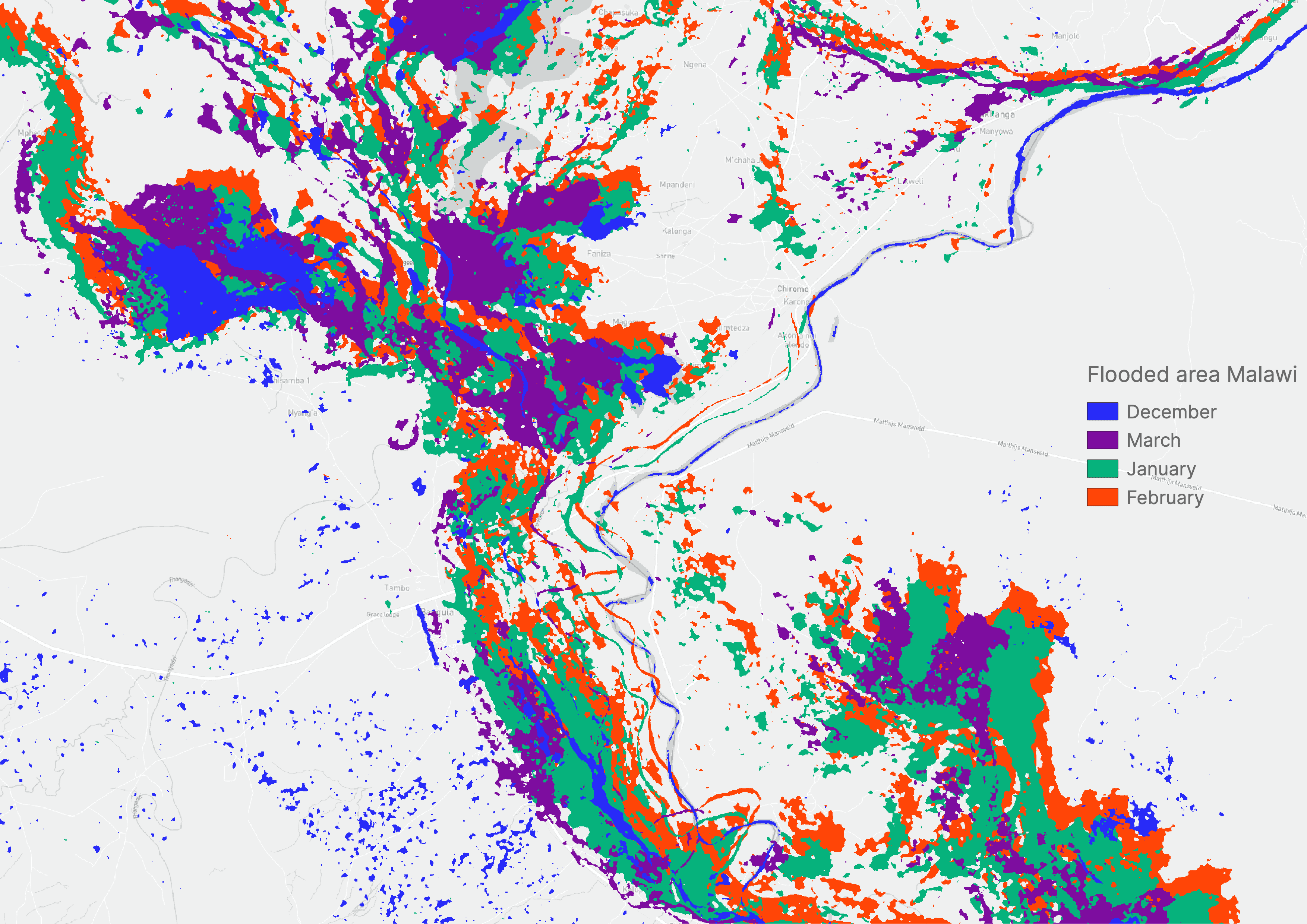
Disaster response: flood extent in southern Malawi, month by month. 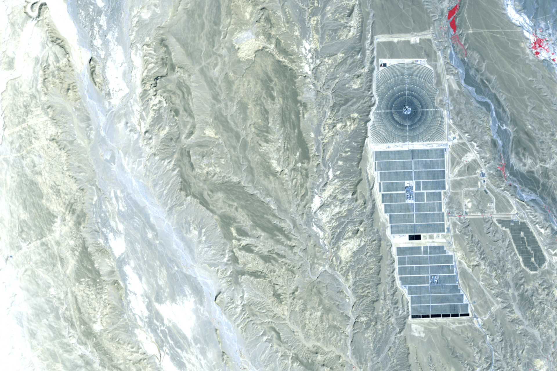
Energy: a solar power plant in the Moroccan desert. 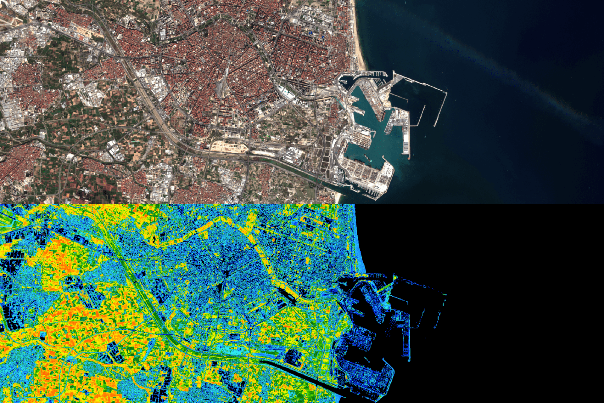
Smart cities: Valencia and its port, as a vegetation index. 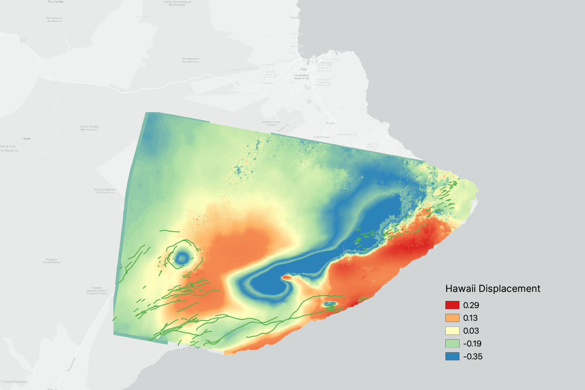
Infrastructure: ground displacement after the 2018 Kīlauea earthquake. 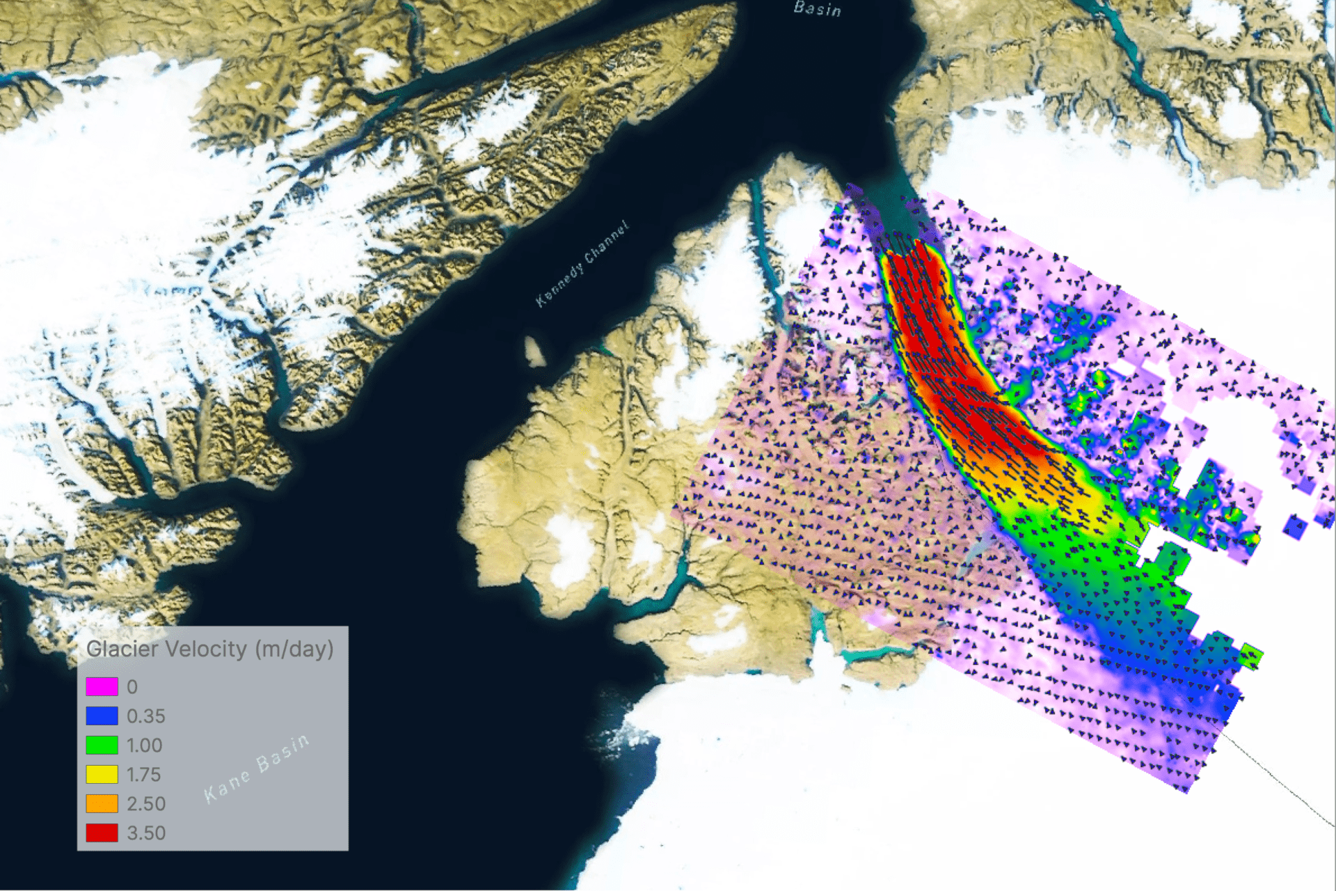
Climate: glacier velocity by the Kennedy Channel, in the high Arctic. 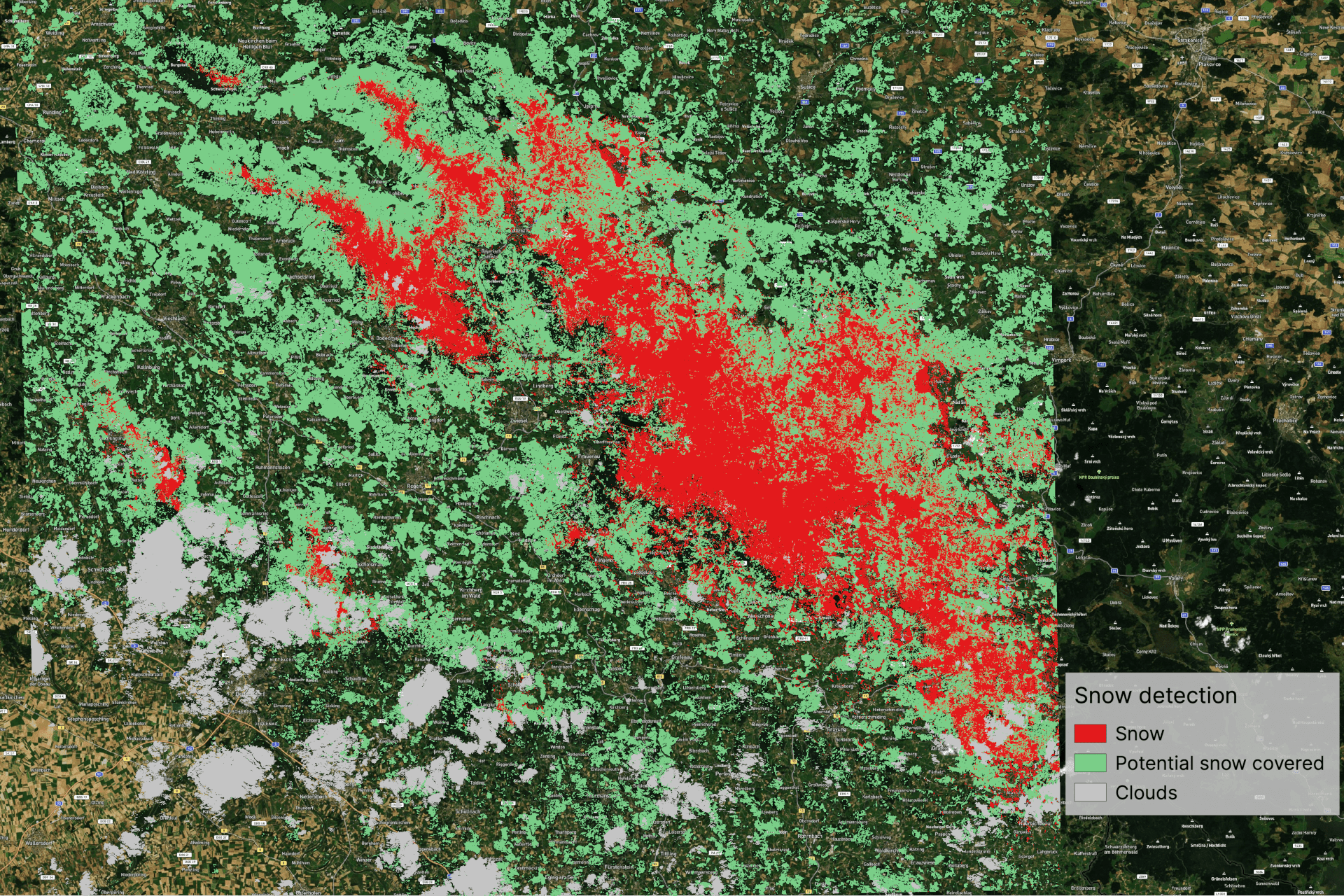
Water: snow cover, told apart from clouds. 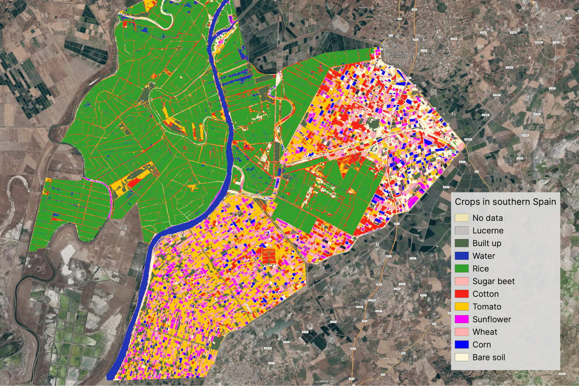
Agriculture: crop types in the rice fields south of Seville. 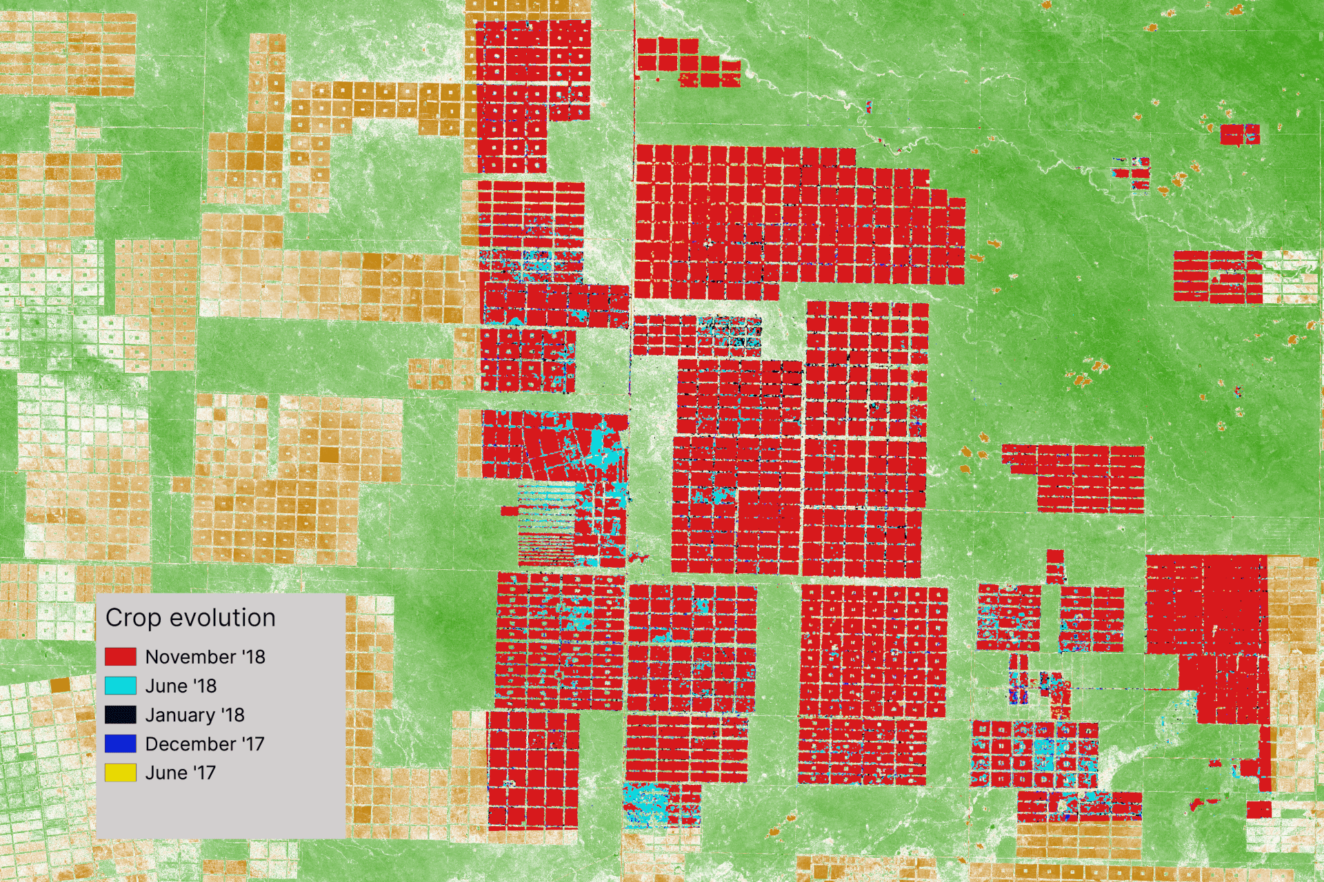
Agriculture: field-by-field changes, June 2017 to November 2018.
In the press
From the first award in 2017 to the pivot in 2020, in print and online.
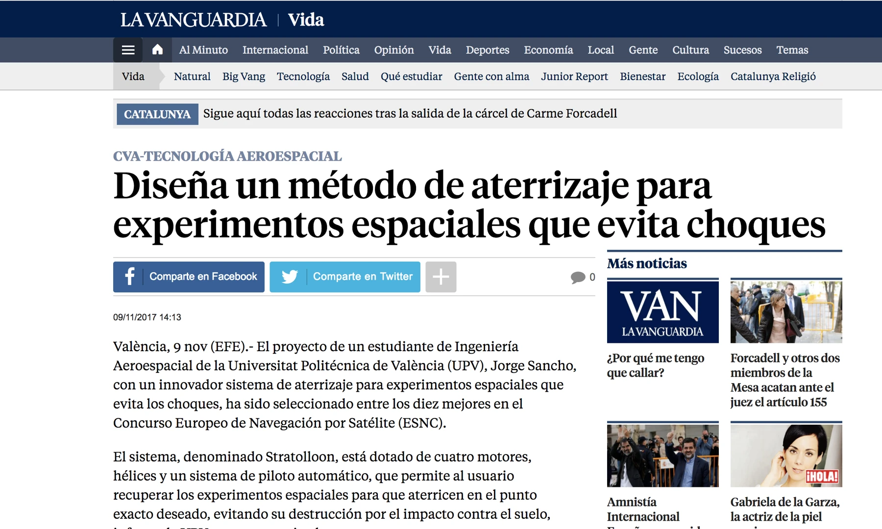
La Vanguardia, 9 November 2017: “Student designs a crash-free landing method for space experiments” 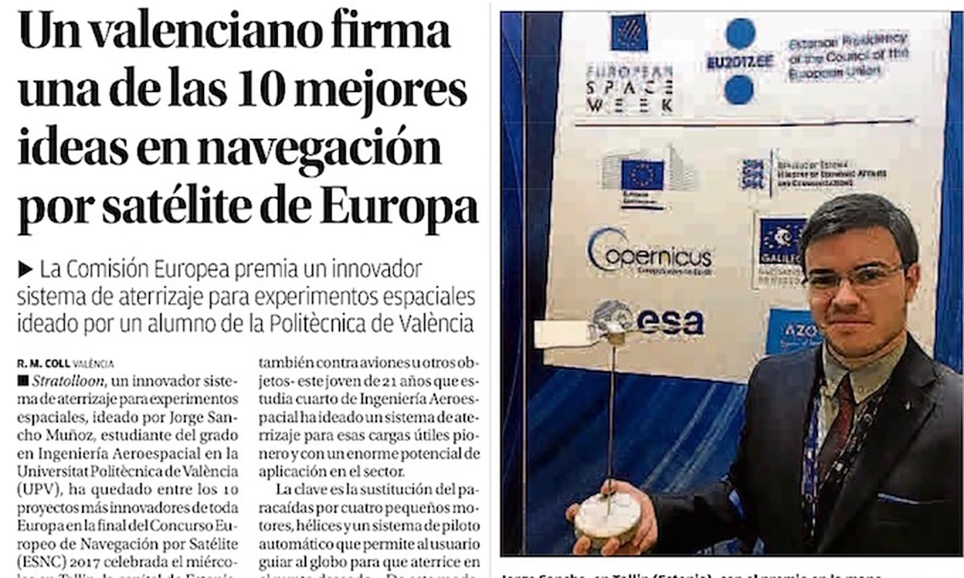
Levante-EMV, print, 10 November 2017: “A Valencian behind one of Europe's 10 best ideas in satellite navigation” 
Las Provincias, Innova+ supplement, 29 November 2017: “‘Stratolloon’, or how to land safely” 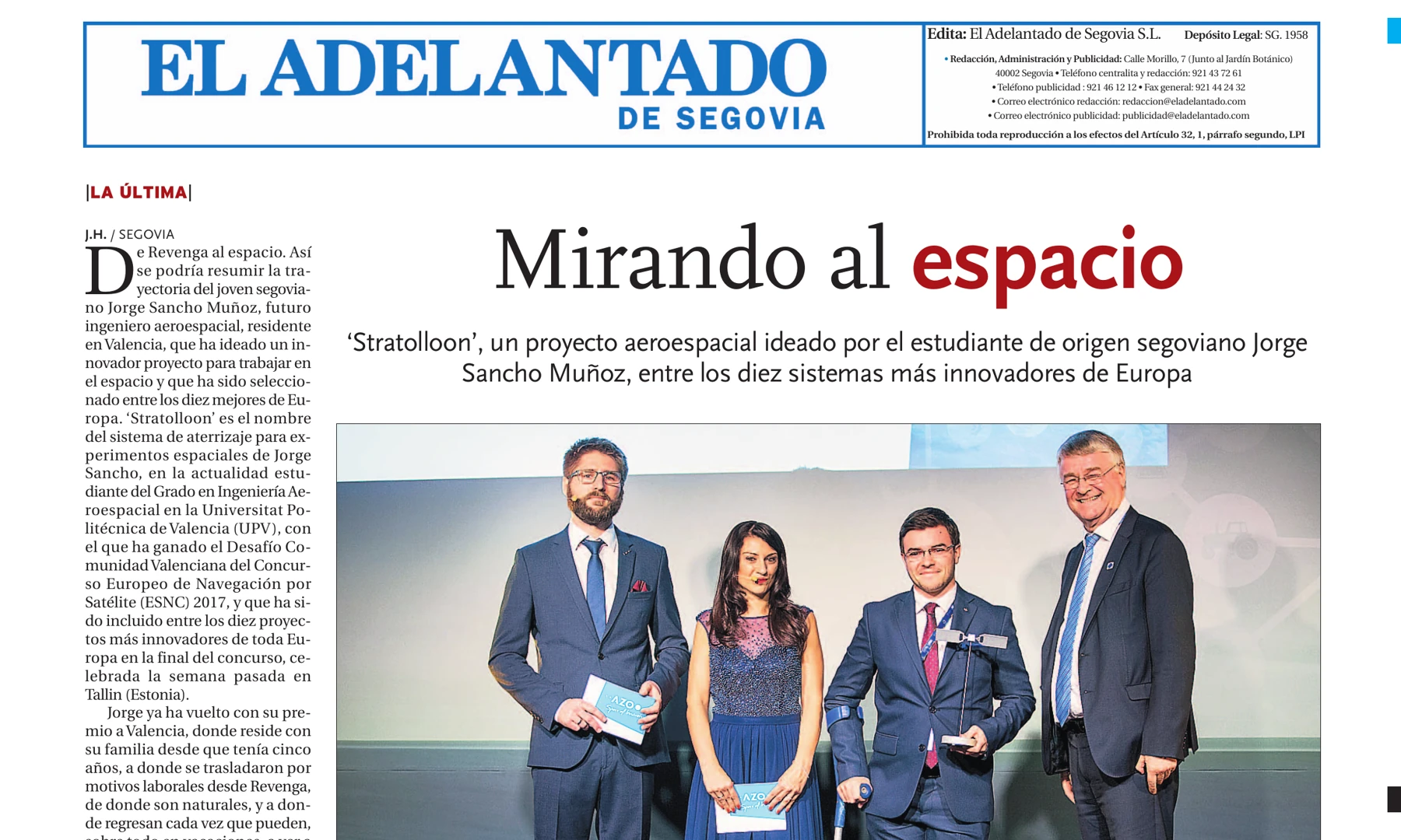
El Adelantado de Segovia, print, 13 November 2017: “Looking to space” 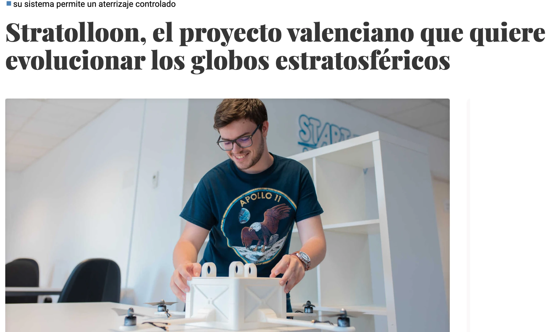
Valencia Plaza, 19 July 2019: “Stratolloon, the Valencian project that wants to reinvent stratospheric balloons” 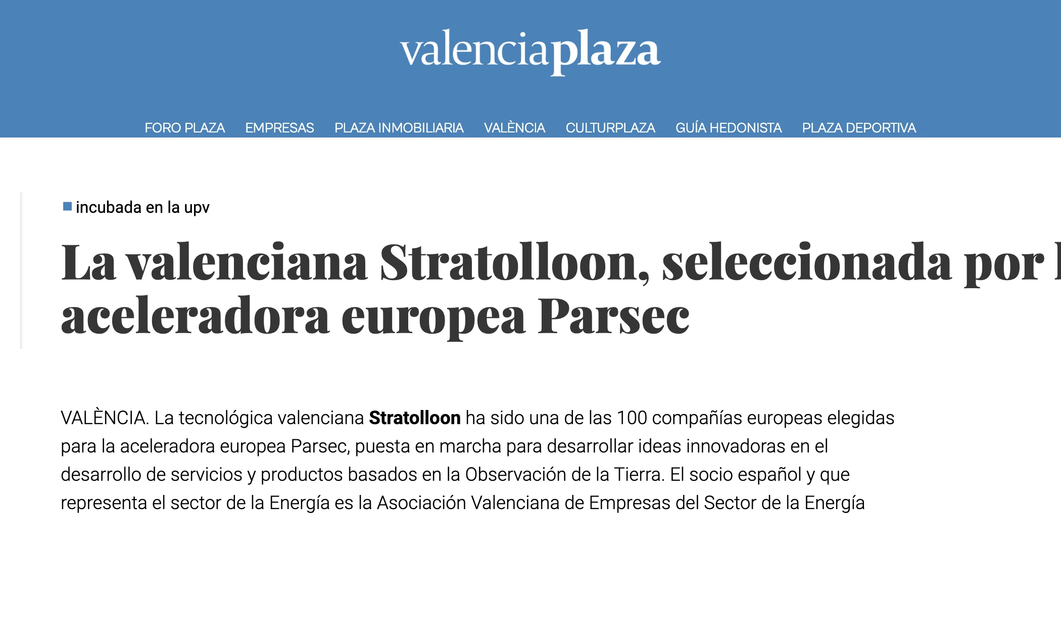
Valencia Plaza, 3 April 2020: “Valencia's Stratolloon selected by the European accelerator Parsec”
With the support of


The founders
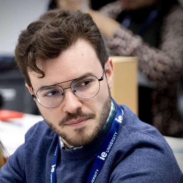
Jorge Sancho Muñoz
CEO and co-founder
The aerospace student who watched a balloon fall and sketched a way to bring it down on purpose. He graduated in Aerospace Engineering from the UPV, then took a master's in startup management.
At Stratolloon he ran the business and pitched the company across Europe, from Valencia to Tallinn. He also conceived the SL-0 and, once the company turned to satellite data, built the imagery analysis engine.
Today he is Head of Product and AI at GPTadvisor, whose AI products run at 25 financial institutions across Europe and Latin America. He still mentors early-stage founders.

Alex Caballero Sánchez
CTO and co-founder
Industrial engineer from the UPV, specialised in product design. His master's thesis, an IoT system for detecting wildfires, was graded 10 out of 10. Before Stratolloon he built smart-factory IoT solutions and 3D-printed prototypes at Schneider Electric.
As CTO he designed the SL-0 in 3D, then wrote the satellite imagery pipeline and the GIS web app the company became, in React, Node.js and Python.
Today he builds AI and LLM products as a senior full-stack engineer, runs Compra Smartphone on the side, and hasn't missed a daily run since January 2021.
The Stratolloon team was acquired in December 2020.
Three years earlier, they were students watching a balloon fall on Los Angeles. This page stays up as the record of everything in between.